
Wayfinding Case Study: City of Sylvania, OH
The City of Sylvania has almost 20,000 residents in 6 1/2 sq miles with a charming historic downtown, a college and a major hospital. It sits between an expressway exit and two major regional sports destinations. The city is sophisticated and elegant with unique business' and amenities throughout the downtown area.
Wayfinding Challenges
The challenges for this project included:
- Travelers to the two sports venues west of town would exit the expressway and pass right next to the downtown without realizing that it is there. One of our goals was to make visitors aware of the downtown and other local amenities.
- Like all community projects there were many invested stakeholders that needed to provide input and be part of the review and approval process. We needed to be able to communicate our strategy and intentions clearly to people that were not used to looking at plans and drawings.
- In addition to informing regional visitors about the downtown we needed to provide wayfinding information to destinations like the college, hospital, museum, chamber of commerce, etc..
- The expressway exit east of town was far enough from town to keep visitors from knowing anything about Sylvania and certainly not be able to understand its character.
- An additional concern was making sure visitors could easily find their way back through town from the sports venues. Being certain of their location and feeling confident they could find the expressway would free them to divert from their path to experience Sylvania's downtown.
Wayfinding Solutions
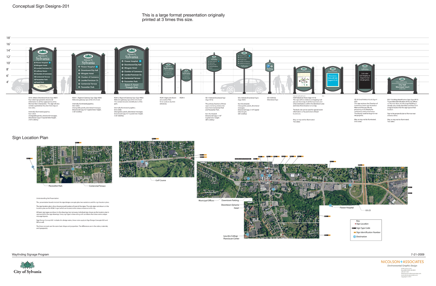
The sign design itself became an important part of our wayfinding strategy by communicating the history and elegance of the city. This was particularly important at the expressway exits where we placed large directional signs in an existing park setting. From that point it was critical that visitors could easily find wayfinding signs and stay connected to the wayfinding system. This was accomplished with unique sign designs that were clearly visible in the environment.
The document directly below shows the design, locations, and messages for all signs so it was easy to communicate our ideas to the public. This document became the final wayfinding document along with a series of similar close up detail pages.
You-are-here Map
The You-are-here map was a critical part of the wayfinding program. It helps visitors orient themselves and promotes local business's. The top part has changeable panels that can be updated as business's come and go. The bottom part would only need to be updated when a new building is built.

Return to Wayfinding Planning page