
Wayfinding Case Study: Midtown Greenway, Detroit
Midtown is Detroits's cultural and education center located a 2 1/2 miles north of downtown. The area includes historic homes, a university, an art college, museums (including the world renowned Detroit Institute of Arts) and many business' and restaurants. The Midtown Greenway is a pedestrian path with enhanced landscaping and hardscaping that winds it's way through the area.
Wayfinding Challenges & Solutions
The most important objective was to keep people on the Greenway path so we placed this information on the top disc. The Greenway path directions are in a dominant position so they will be seen first from a distance. Directional information for other institutions and amenities was included on a changeable panel closer to eye level.
In the illustration below you'll see the secondary directional message on a half circle panel on the far left and right. On the rectangular panels we added you-are-here maps and information about the institutions in the vicinity. Each sign had an opportunity to display four panels, one on each side.

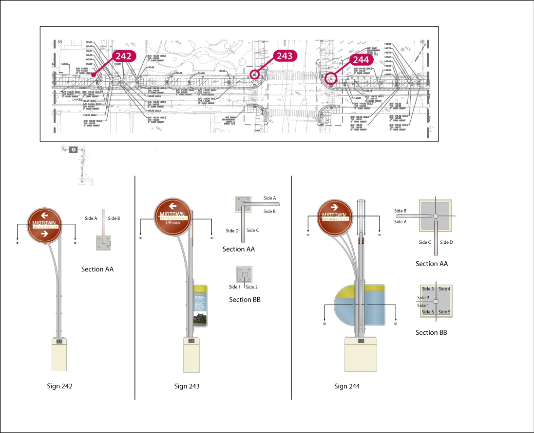
Wayfinding Sign Location Plan
Below is a typical page from the Sign Location Plans. The plan shows a detailed section of the site with precise sign locations noted. The plan also shows an elevation of the sign with an orientation key so the correct information is displayed in the right direction. This concern was enhanced with the addition of the amenity information and the you-are-here maps. See below.
We also wanted to include directions to nearby attractions including Eastern Market, the Dequindre Cut, and the Detroit River Walk. Since they were some distance away we included the number of miles to make sure walkers were aware of the time commitment they were making.